
Evaluation Methods of Change Detection of Seagrass Beds in the Waters of Pajenekang and Gusung Selayar
DOI:
https://doi.org/10.48048/tis.2021.677Keywords:
Dynamics, Spatial, Benthic habitat, Change analysis, ClassificationAbstract
Knowledge about coastal and small island ecosystems is increasing for the monitoring of marine resources based on remote sensing. Remote sensing data provides up-to-date information with various resolutions when detecting changes in ecosystems. Studies have defined a shift in marine resources but were limited only to pixel or object classification in changes of seagrass area. In the present study, two classification method analysis approaches were compared to obtain optimum results in detecting changes in seagrass extent. It aimed to determine the dynamics of a seagrass ecosystem by comparing two classification methods in the waters of Gusung Island and Pajenekang, South Sulawesi, these methods being pixel-based and object-based classification methods. This research used SPOT-7 satellite imagery with 6 m2 of spatial resolution. Accuracy assessment using the confusion matrix showed optimum accuracy in object-based classification with an accuracy value of 87 %. Meanwhile, pixel-based classification showed an accuracy value of 78 % around Gusung Island. Pajenekang Island had accuracy values of 69 % with object-based classification and 65 % with pixel-based classification. A comparison of both classification methods revealed statistically high accuracy in mapping the benthic habitats of seagrass ecosystems. The results of the classifications showed a decline in the area of seagrass populations around Gusung Island from 2016 - 2018 and around Pajenekang Island from 2013 - 2017, with a change rate of 11.8 % around the island of Gusung and 7.6 % around the island of Pajenekang. This can explain the reason for the temporal method of object-based research classification having the best potential to process data changes in areas of seagrass in South Sulawesi waters and remote sensing information for the mapping of coastal area ecosystems.
HIGHLIGHTS
- Information on coastal ecosystems globally with remote sensing data is currently very easy to access, but information related to ecosystem management and seagrass ecology in certain areas is still limited
- Analysis of seagrass benthic changes in shallow water requires data processing methods with high accuracy
- The OBIA (Object Based Image Analysis) method is one of the analytical methods that can provide optimal results in observing changes in seagrass ecosystems in the waters of South Sulawesi, Indonesia
GRAPHICAL ABSTRACT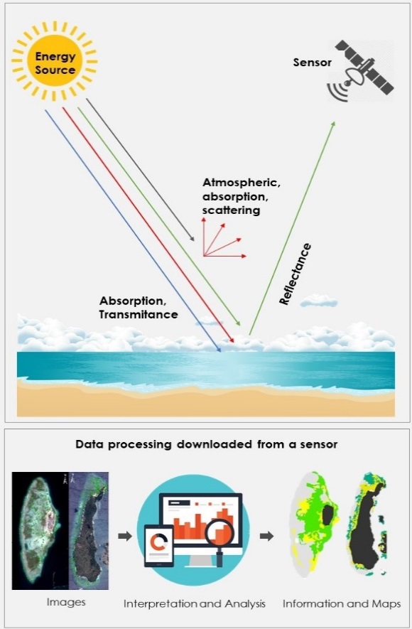
Downloads
References
JP Kritzer, MB Delucia, E Greene, C Shumway, MF Topolski, J Thomas-Blate, LA Chiarella, KB Davy and K Smith. The importance of benthic habitats for coastal fisheries. BioScience 2016; 66, 274-84.
JB Lamb, JAJMVD Water, DG Bourne, C Altier, MY Hein, EA Fiorenza, N Abu, J Jompa and CD Harvell. Seagrass ecosystems reduce exposure to bacterial pathogens of humans, fishes, and invertebrates. Science 2017; 355, 731-3.
CM Duarte, WC Dennison, RJW Orth and TJB Carruthers. The charisma of coastal ecosystems: addressing the imbalance. Estuar. Coast. 2008; 31, 233-8.
LL Griffiths, RM Connolly and CJ Brown. Critical gaps in seagrass protection reveal the need to address multiple pressures and cumulative impacts. Ocean Coast. Manag. 2020; 183, 104946.
NDM Sjafrie, UE Hernawan, B Prayudha, IH Supriyadi, MY Iswari, Rahmat, K Anggraini, S Rahmawati and Suyarso. Indonesian seagrass beds status Ver. 02. LIPI, Jakarta, 2018, p. 4-24.
RJ Orth, TJB Carruthers, WC Dennison, CM Duarte, JW Fourqurean, KL Heck, AR Hughes, GA Kendrick, WJ Kenworthy, S Olyarnik, FT Short, M Waycott and SL Williams. A global crisis for seagrass ecosystems. BioScience 2006; 56, 987-96.
MS Hossain, JS Bujang, MH Zakaria and M Hashim. Application of Landsat images to seagrass areal cover change analysis for Lawas, Terengganu and Kelantan Malaysia. Continent. Shelf Res. 2015; 110, 124-48.
J Kohlus, K Stelzer, G Muller and S Smollich. Mapping seagrass (Zostera) by remote sensing in The Scleswig-Holstein Wadden Sea. Estuar. Coast. Shelf Sci. 2020; 238, 106699.
S Sengupta, BK Ersboll and A Stockmarr. Seagrass detect: A novel method for the detection of seagrass from unlabelled underwater videos. Ecol. Informat. 2020; 57, 101083.
L Su and Y Huang. Seagrass resource assessment using worldview-2 imagery in the Redfish Bay, Texas. J. Mar. Sci. Eng. 2019; 7, 98.
R Baumstark, R Duffey and R Pu. Mapping seagrass and colonized hard bottom in Spring Coast, Florida using Worldview-2 satellite imagery. Estuar. Coast. Shelf Sci. 2016; 181, 83-92.
CF Chen, VK Lau, NB Chang, NT Son, PHS Tong and SH Chiang. Multi-temporal change detection of seagrass beds using integrated Landsat TM/ETM+/OLI imageries in Cam Ranh Bay, Vietnam. Ecol. Informat. 2016; 35, 43-54.
MB Lyons, CM Roelfsema and SR Phinn. Towards understanding temporal and spatial dynamics of seagrass landscapes using time-series remote sensing. Estuar. Coast. Shelf Sci. 2013; 120, 42-53.
MS Hossain, JS Bujang, MH Zakaria and M Hashim. International journal of remote the application of remote sensing to seagrass ecosystems: An overview and future research prospects. Int. J. Rem. Sens. 2014; 36, 61-114.
MB Lyons, SR Phinn and CM Roelfsema. Long term land cover and seagrass mapping using landsat and object-based image analysis from 1972 To 2010 in the Coastal Environment of South East Queensland, Australia. ISPRS J. Photogram. Rem. Sens. 2012; 71, 34-46.
MS Hossain, M Hashim, JS Bujang, MH Zakaria and AM Muslim. Assessment of the impact of coastal reclamation activities on seagrass meadows in Sungai Pulai Estuary, Malaysia, using Landsat data (1994 - 2017). Int. J. Rem. Sens. 2018; 40, 3571-605.
RKF Unsworth, LJ McKenzie, CJ Collier, LC Cullen-Unsworth, CM Duarte, JS Eklöf, JC Jarvis, BL Jones and LM Nordlund. Global challenges for seagrass conservation. Ambio 2019; 48, 801-15.
K Navulur. Multispectral image analysis using the object-oriented paradigm. CRC Press, Boca Raton, Florida, 2006, p. 165.
SL Benfield, HM Guzman, JM Mair and JAT Young. Mapping the distribution of coral reefs and associated sublittoral habitats in Pacific Panama: A comparison of optical satellite sensors and classification methodologies. Int. J. Rem. Sens. 2007; 28, 5047-70.
T Blaschke. Object based image analysis for remote sensing. ISPRS J. Photogramm. Rem. Sens. 2010; 65, 2-16.
K Topouzelis, D Makri, N Stoupas, A Papakonstantinou and S Katsanevakis. Seagrass mapping in Greek territorial waters using Landsat-8 satellite images. Int. J. Appl. Earth Obs. Geoinform. 2018; 67, 98-113.
CM Roelfsema, M Lyons, EM Kovacs, P Maxwell, MI Saunders, J Samper-Villarreal and SR Phinn. Multi-temporal mapping of seagrass cover, species, and biomass: A semi-automated object-based image analysis approach. Rem. Sens. Environ. 2014; 150, 172-87.
TP Ilyas, B Nababan, H Madduppa and D Kushardono. Accuracy assessment of several classification algorithms with and without hue saturation intensity input features on object analyses on benthic habitat mapping in the Pajenekang island waters, South Sulawesi. In: Proceedings of the 3rd International Conference on Marine Science, Bogor, Indonesia. 2019.
R Pu, S Bell, C Meyer, L Bagget and Y Zhao. Mapping and assessing seagrass along the Western Coast of Florida using Landsat TM and EO-1 ALI/Hyperion imagery. Estuar. Coast. Shelf Sci. 2012; 115, 234-45.
BPS-Statistic of Kepulauan Selayar Regency. Kepulauan Selayar Regency in Figures. BPS-Statistic Indonesia, 2021, p. 358.
JLS Ooi, GA Kendrick, KPV Niel and YA Affendi. Knowledge gaps in tropical southeast asian seagrass systems. Estuar. Coast. Shelf Sci. 2011; 92, 118-31.
AD Priyanto. 2020, Integrating coral reef ecosystems services into marine planning, Ph.D. Dissertation. The University of Queensland, Queensland, Australia.
A Tuwo, M Yunus, R Aprianto and J Tresnati. Marine ecotourism development in South Sulawesi, Indonesia. IOP Conf. Ser. Earth Environ. Sci. 2020; 763, 012068.
MS Thalib, N Nurdin and A Aris. The ability of Lyzenga’s algorithm for seagrass mapping using Sentinel-2A imagery on small island, Spermonde Archipelago, Indonesia. IOP Conf. Ser. Earth Environ. Sci. 2018; 165, 012028.
DR Lyzenga. Remote sensing of bottom reflectance and water attenuation parameters in shallow water using aircraft and Landsat data. Int. J. Rem. Sens. 1981; 2, 71-82.
N Wahidin, VP Siregar, B Nababan, I Jaya and S Wouthtuyzen. Object-based image analysis for coral reef benthic habitat mapping with several classification algorithms. Proc. Environ. Sci. 2015; 24, 222-7.
U Avci, M Karaman, E Ozelkan and I Papila. A comparison of pixel-based and object-based classification methods, a case study: Istanbul, Turkey. In: Proceedings of the 34th International Symposium on Remote Sensing of Environment, Sydney, Australia. 2011.
R Weih and ND Riggan. Object-based classification vs pixel-based classification: Comparative importance of multi-resolution imagery. In: Proceedings of the International Archives of the Photogrammetry, Remote Sensing and Spatial Information Sciences, Calgary, Canada. 2008.
S Xiaoxia, Z Jixian and L Zhengjun. A comparison of object-oriented and pixel-based classification approach using Quickbird imagery. In: Proceedings of the International Symposium on Spatio-temporal Modeling, Spatial Reasoning, Analysis, Data Mining and Data Fusion, Beijing, China. 2005.
Trimble. Ecognition developer: User guide. Trimble Germany GmbH, Munich, Germany, 2014.
A Anggoro, E Sumartono, VP Siregar, SB Agus, D Purnama, Supriyono, DA Puspitosari, T Listyorini, B Sulistyo and Parwito. Comparing object-based and pixel-based classifications for benthic habitats mapping in Pari Islands. J. Phys. Conf. Ser. 2018; 1114, 012049.
PS Sisodia, V Tiwari and A Kumar. Analysis of supervised maximum likelihood classification for remote sensing image. In: Proceedings of the IEEE International Conference on Recent Advances and Innovations in Engineering, Jaipur, India. 2014.
J Sun, J Yang, C Zhang, W Yun and J Qu. Automatic remotely sensed image classification in a grid environment based on the maximum likelihood method. Math. Comput. Model. 2013; 58, 573-81.
J Yang, Z Ye, X Zhang, W Liu and H Jin. Attribute weighted Naive Bayes for remote sensing image classification based on cuckoo search algorithm. In: Proceedings of the 2017 International Conference on Security, Pattern Analysis, and Cybernetics (SPAC), Shenzhen, China. 2017.
E Barca, A Castrignano, S Ruggieri and M Rinaldi. A new supervised classifier exploiting spectral-spatial information in the bayesian framework. Int. J. Appl. Earth Obs. Geoinform. 2020; 86, 101990.
GL Mountford, PM Atkinson, J Dash, T Lankester and S Hubbard. Sensitivity of vegetation phenological parameters: From satellite sensors to spatial resolution and temporal compositing period. Elsevier, Amsterdam, Netherlands, 2017, p. 448.
I Coelkesen and T Kavzoglu. Comparative evaluation of decision-forest algorithms in object-based land use and land cover mapping. Elsevier, Amsterdam, Netherlands, 2019, p. 499-517.
RG Congalton and K Green. Assessing the accuracy of remotely sensed data principles and practices. 2nd ed. CRC Press, Boca Raton, Florida, 2009, p. 183.
P Doydee and V Siregar. Assessment of coastal land use changes in Banten Bay, Indonesia using different change detection methods. Biotropia 2006; 3, 122-31.
JT Nugroho, Zylshal, NM Sari and D Kushardono. A comparison of object- based and pixel-based approaches for land use/land cover classification using LAPAN-A2 microsatellite data. Int. J. Rem. Sens. Earth Sci. 2017; 14, 27-36.
D Lu and Q Weng. A survey of image classification methods and techniques for improving classification performance. Int. J. Rem. Sens. 2007; 28, 823-70.
R Baumstark, R Duffey and R Pu. Mapping seagrass and colonized hard bottom in spring coast, Florida using worldview-2 satellite imagery. Estuar. Coast. Shelf Sci. 2016; 181, 83-92.
GJ Hay and G Castilla. Object-based image analysis: Strengths, weaknesses, opportunities and threats (swot). In: Proceedings of the 1st International Conference on Object-based Image Analysis, Salzburg, Austria. 2006.
MD Hossain and D Chen. Segmentation for object-based image analysis (obia): A review of algorithms and challenges from remote sensing perspective. ISPRS J. Photogram. Rem. Sens. 2019; 150, 115-34.
MC Leon-Perez, RA Armstrong, WJ Hernandez, A Aguilar-Perera and J Thompson-Grim. Seagrass cover expansion off Caja De Muertos Island, Puerto Rico, as determined by long-term analysis of historical aerial and satellite images (1950 - 2014). Ecol. Indicat. 2020; 117, 106561.
SR Phinn, CM Roelfsema and PJ Mumby. Multi-scale, object-based image analysis for mapping geomorphic and ecological zones on coral reefs. Int. J. Rem. Sens. 2012; 33, 3768-97.
Millennium Ecosystem Assessment (MEA). Ecosystem and human well-being: Current state and trends. Vol 1. Island Press, Washington DC, 2005, p. 1-23.
RC Phillips and EG Menez. Seagrasses. Smithsonian Institution Press, Washington DC, 1988, p. 19-27.
V Siregar and AF Koropitan. Land use change and its impact to marine primary production in Semarang Waters. Proc. Environ. Sci. 2016; 33, 520-31.
MH Zakaria and JS Bujang. Disturbances in seagrass ecosystem in Malaysia. In: H Ogawa, JS Bujang and MH Zakaria (Eds.). Resource status and trends in Indonesia, Japan, Malaysia, Thailand, Vietnam. Seizando-Shoten Publishing, Tokyo, Japan. 2011.
JLS Ooi, GA Kendrick and KPV Niel. Effects of sediment burial on tropical ruderal seagrasses are moderated by clonal integration. Cont. Shelf Res. 2011; 31, 1944-54.
EP Green and FT Short. World atlas of seagrasses. University of California Press, Berkeley, 2003, p. 324.
M Bjork, FT Short, E Mcleod and S Beer. Managing seagrasses for resilience to climate change. IUCN, Gland, Switzerland, 2008, p. 56.

Downloads
Published
How to Cite
Issue
Section
License

This work is licensed under a Creative Commons Attribution-NonCommercial-NoDerivatives 4.0 International License.